Posts

Showing posts from March, 2022

Flat Laurel Creek to Little Sam's Knob 3-16-2022

Image
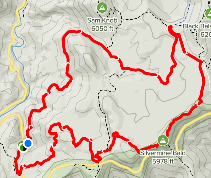
RAIN, postponed to March 23. The hike for March 16 is a loop hike of about  8 miles, located south of Waynesville. It is Flat Laurel  Creek to Little Sam's Knob, and back to hwy 215 and the parking  area. One good route is to follow the Blue Ridge Parkway to hwy 215, then turn left. The parking area is a short distance beyond the turn and on the right side of the road. We will meet at Poteet  Park at 9:00 AM.  The map above is not totally accurate in that it shows a route going around an unmarked knob which is Little Sam's Knob and a connecting trail that shortcuts the longer red line and a return to the parking lot. It looks like there are many "option" routes and shorter routes that could meet the wide interests of our group, and the actual route will be explained Wednesday morning.

Ellicott Rock via Bad Creek Trail 3/9

Image
(Click to enlarge.) This is a very special place. The destination for this approximately 5 mile in-out hike takes us into the heart of the 8,000 plus acres of the Ellicott Rock Wilderness area (see map for its trails)  that was begun in 1975 and expanded in 1984. This unique 3 state wilderness area  is named after a famous surveyor (Major Andrew Ellicott) who chiseled a rock N-G along the Chattooga River on December 26, 1811 to attempt to settle a boundary dispute, an effort which gave 18 miles of territory to North Carolina that Georgia claimed. It is the only wilderness area to include territory from 3 states and 3 national forests and further includes a separately designated "wild and scenic" river corridor running through its heart like a bent spear. It includes 3 interesting waterfalls: Spoonauger Falls, King Creek Falls and the somewhat hidden Fowler Creek Falls. For further details on its many opportunities see the U.S. Park Service web site . We met at Cullowhee Recr